
Storm Mitigation & Hurricane Assessment
When the Storm Passes, the Work Begins
Aerial documentation of storm surge infrastructure, flood control projects, and hurricane damage assessment along the Gulf Coast.
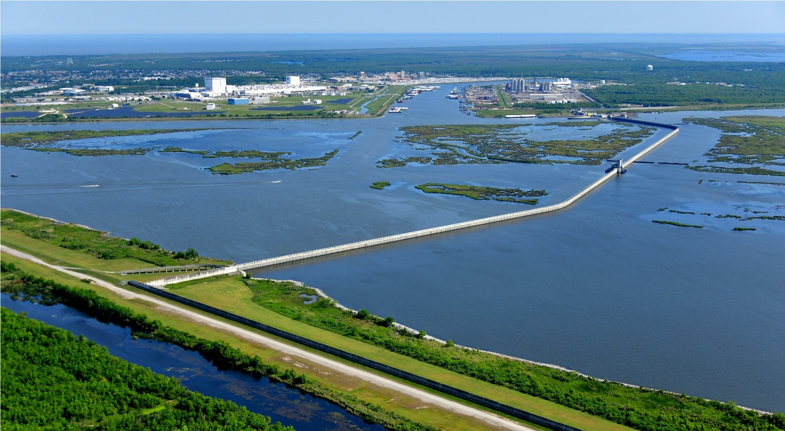
Inner Harbor Navigation Canal, New Orleans, Louisiana
The IHNC Lake Borgne Surge Barrier
The Inner Harbor Navigation Canal Lake Borgne Surge Barrier stretches 1.8 miles across the confluence of the IHNC, the Gulf Intracoastal Waterway, and Bayou Bienvenue the largest design-build Civil Works project in the history of the U.S. Army Corps of Engineers. Completed in 26 months at a cost of $1 billion, the barrier stands 25 feet tall and is anchored by more than 4,000 piles driven as deep as 190 feet into the Louisiana marsh.
From altitude, the scale of the structure is impossible to miss a concrete wall bisecting open water, flanked by sector gates and a vertical lift gate, protecting the east bank of New Orleans from the kind of catastrophic surge that devastated the city during Hurricane Katrina. We documented this project from the air throughout construction and after completion, providing contractors and agencies with a visual record of one of the most consequential flood control projects in American history.
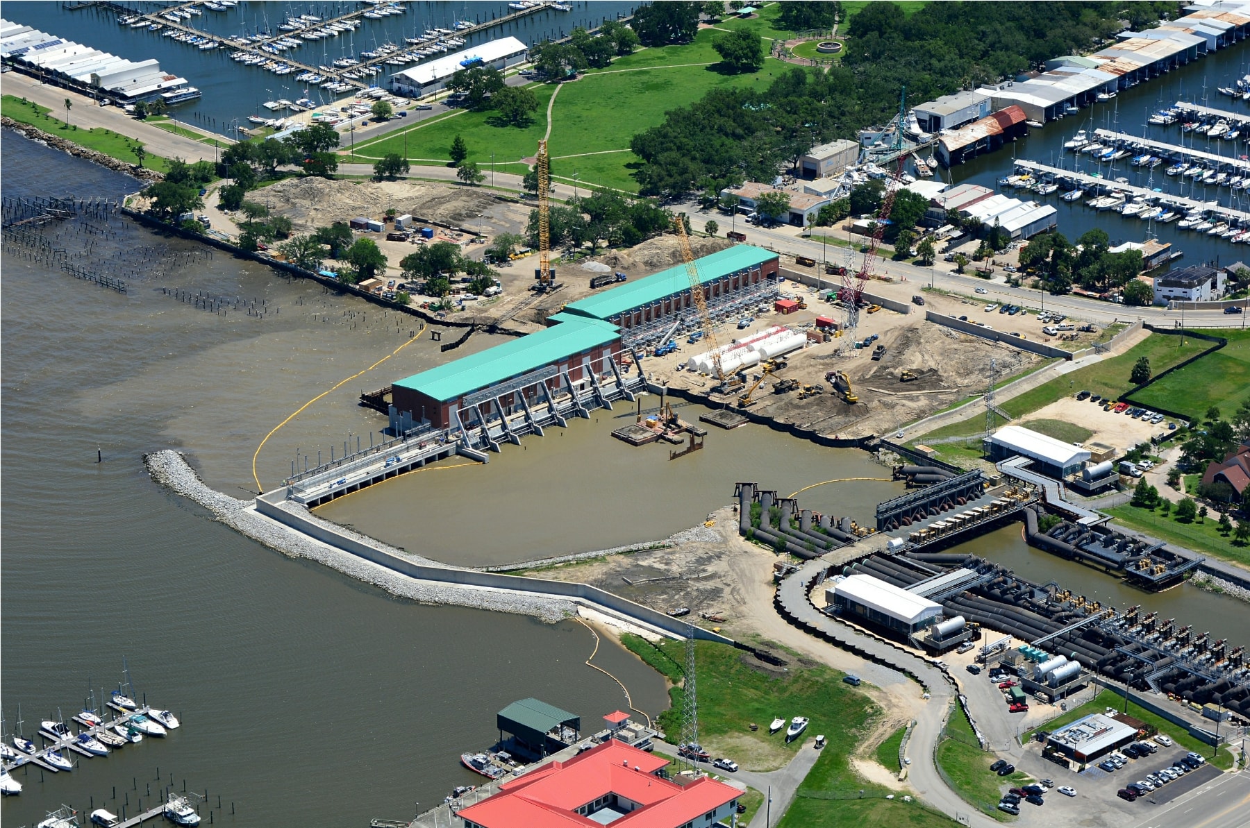
New Orleans, Louisiana
Pump Station Construction in Progress
A new pump station takes shape along the New Orleans waterfront, its teal-roofed turbine hall rising above the surrounding marina and residential neighborhoods. The construction site sprawls across the frame cofferdams, pipe staging, cranes, and the freshly poured concrete of the floodwall tie-in visible from above in a way no ground-level photograph could capture.
Aerial photography is the standard of record for projects like this progress documentation for contractors, compliance imagery for agencies, and a visual timeline that survives long after the equipment moves on. We fly these sites at every major milestone, giving project teams the documentation they need.
Gulf Coast Hurricane Ida Damage Assessment
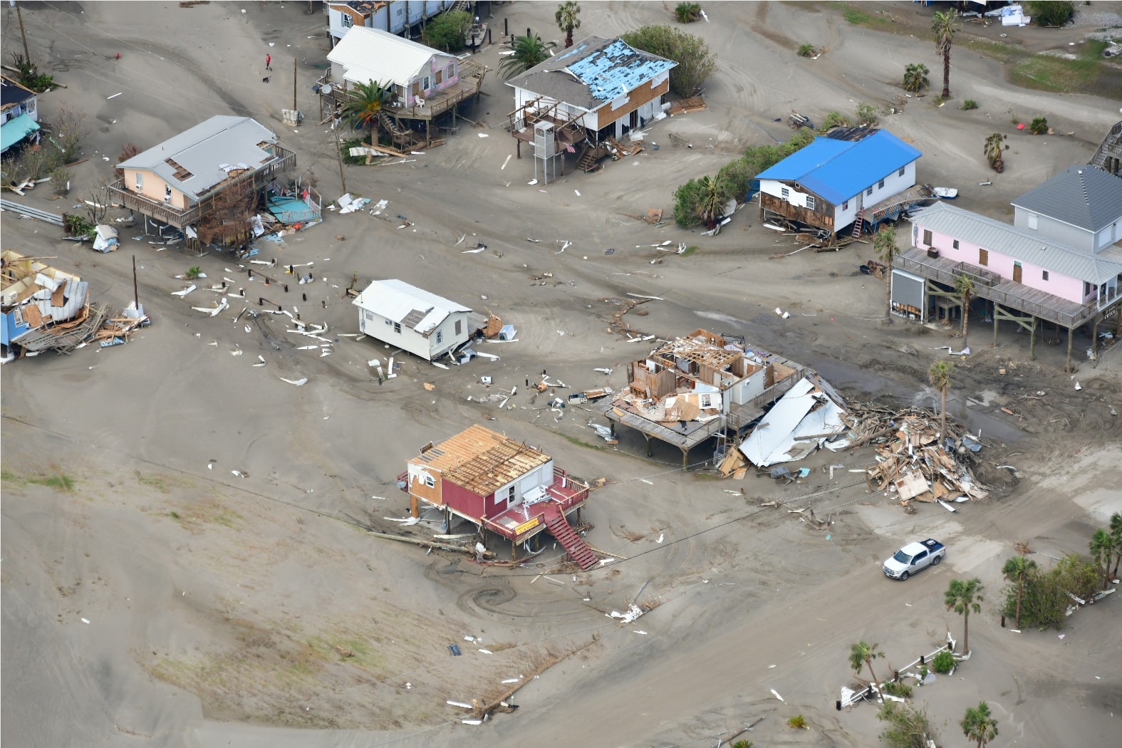
The Morning After: Ida's Footprint
Hours after Hurricane Ida made landfall, we were airborne. The coastal community below tells the story without words roofs stripped to bare framing, walls collapsed into debris fields, sand pushed deep into streets that were dry the day before. The blue tarps and the absence of cars mark the homes that were occupied; the rubble piles mark the ones that weren't built to survive a direct hit from a Category 4 storm.
Post-storm aerial documentation is time-critical work. Insurance adjusters, emergency managers, FEMA, and parish officials all need this imagery within the first 24 to 72 hours before cleanup begins, before debris is moved, while the damage record is still intact. We have flown the immediate aftermath of multiple Gulf Coast storms, providing the aerial documentation that drives response and recovery decisions.
Coastal Louisiana Hurricane Ida Aftermath
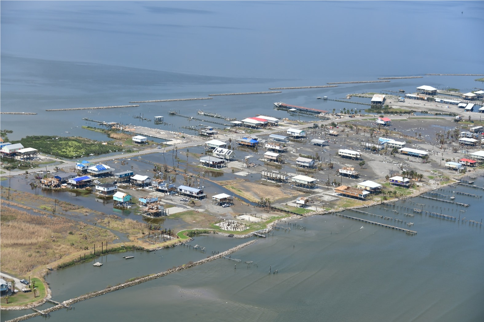
A Community Underwater
A coastal Louisiana community sits in the grip of Hurricane Ida's surge streets flooded, docks shattered, the grid of a small town visible only because the water hasn't risen high enough to erase it entirely. Broken pilings line the waterfront where fishing camps and boat slips stood the week before. The scale of the inundation is only legible from the air.
Images like this become part of the official record submitted to state and federal agencies, used in damage assessments, and referenced for years in the planning of the next round of storm protection infrastructure. The Gulf Coast is always rebuilding. We document every stage of that cycle.
USACE New Orleans District
IHNC Lake Borgne Surge Barrier
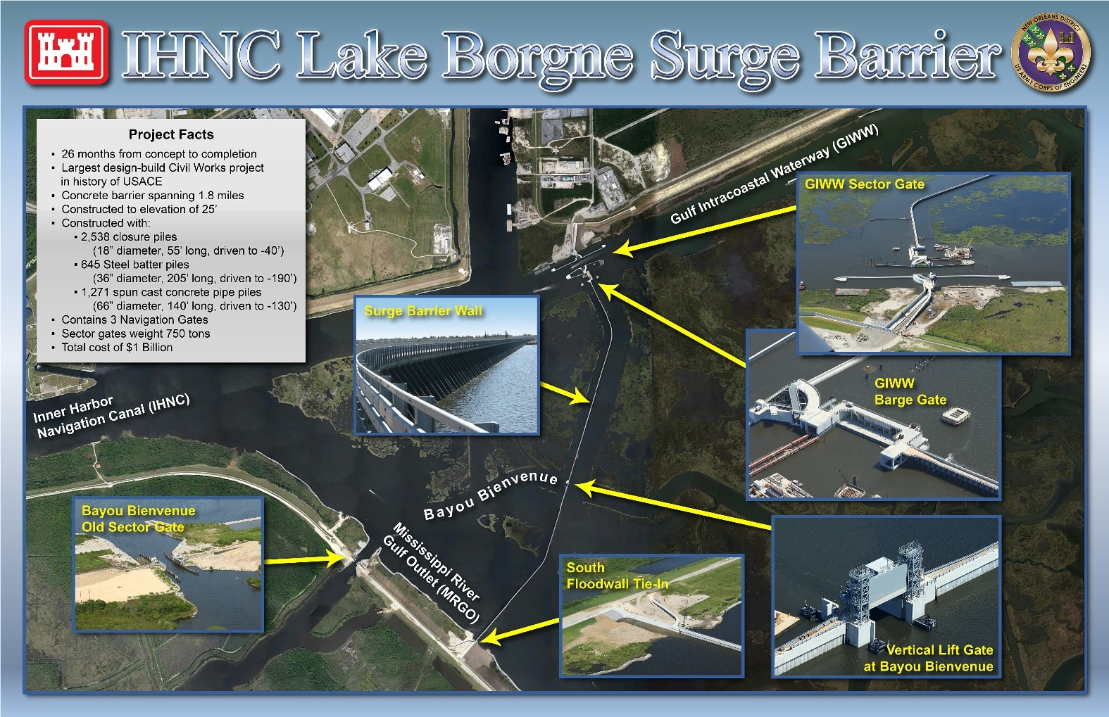
Project Facts
- 26 months from concept to completion
- Largest design-build Civil Works project in the history of USACE
- Concrete barrier spanning 1.8 miles
- Constructed to elevation of 25 feet
- 2,538 closure piles 18″ diameter, 55′ long, driven to −40′
- 645 steel batter piles 36″ diameter, 205′ long, driven to −190′
- 1,271 spun cast concrete pipe piles 66″ diameter, 140′ long, driven to −130′
- Contains 3 Navigation Gates
- Sector gates weigh 750 tons each
- Total project cost: $1 Billion
Key Structures